|
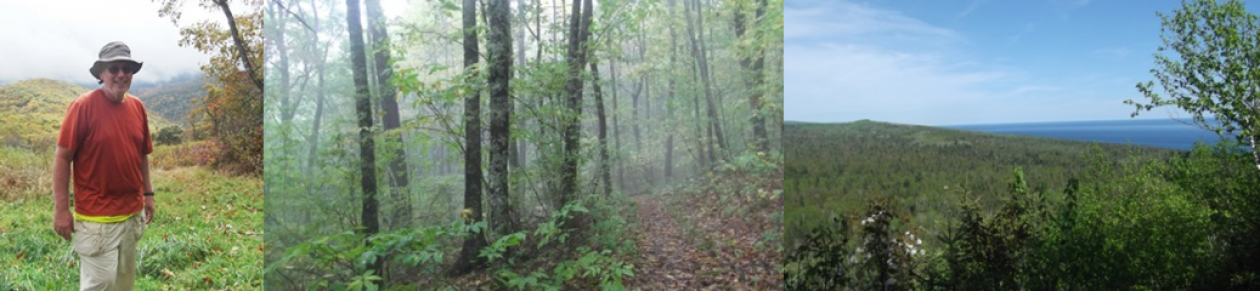
BELL MOUNTAIN (NORTH LOT TO HIGHWAY A)
|
|
|
|
|
| MILE MARKER: | DESCRIPTION: | |
|---|---|---|
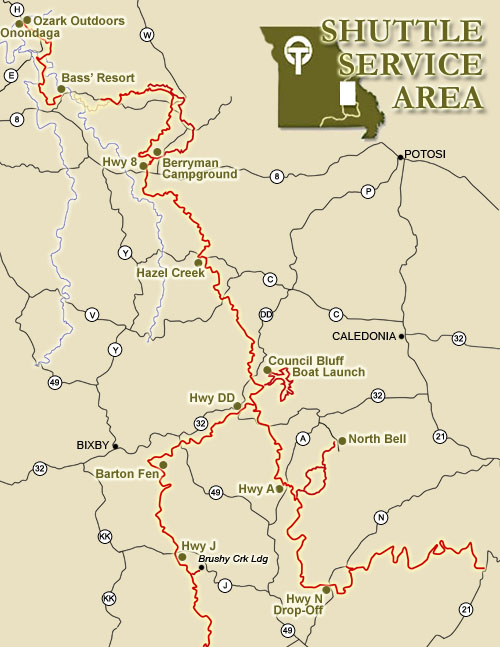
| 0 | Start at North Bell Trailhead.  (directions) (directions)North Bell Trailhead. About 1.8 miles down a gravel road off Highway A. Lot is on right and is signed. |
|
| North Bell Trailhead to Joe’s Creek North Connector – 2.4 miles | ||
| 2.4 | Continue straight past the Joes Creek turn-off toward the summit. | |
| Joe’s Creek North Connector to Bell Mountain Peak – 1.3 miles | ||
| 3.4 | Open glades that look for miles to the west– a great spot to catch a beautiful sunset. | |
| 3.6 | Along the north ridge of the summit you’ll find several informal paths that lead east to glades overlooking the St. Francis Mountains. Definitely a five-star view! | |
| 3.7 | Stop for a second and take in the view from the top of Bell Mountain. | |
| Bell Mountain Peak to Joe’s Creek South Connector – 1.6 miles | ||
| 5 | A stock pond can be found on the south side of the trail. | |
| 5.2 | At the ‘Y’ in the trail, keep to the left. | |